
The geospatial technology industry is undergoing a fundamental shift. Mapping is no longer simply about representing roads, buildings, or land on a digital screen. As artificial intelligence, digital twins and real-time data reshape the way businesses and governments understand the physical world, geospatial technology is emerging as a critical intelligence layer for the modern economy.
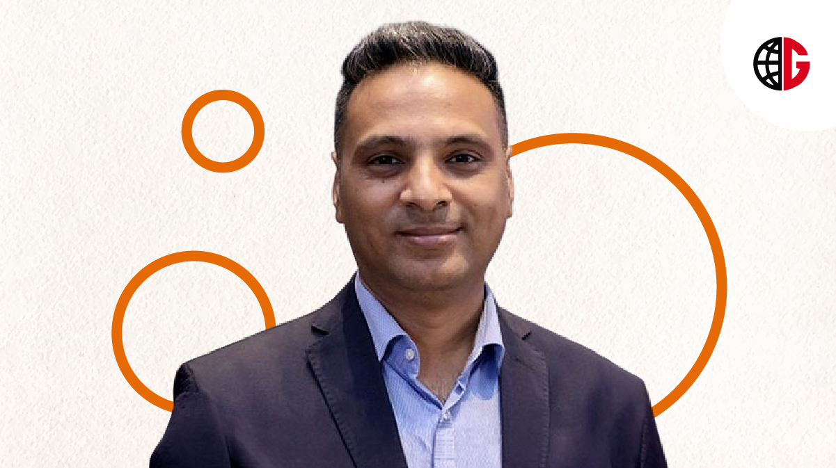
Against this backdrop, Genesys International Corporation has appointed Nikhil Alulkar as Chief Executive Officer, placing the company at an important inflection point in its growth journey. Alulkar will lead Genesys’ operations, business execution and expansion strategy as the company seeks to scale its AI-native mapping, Digital Twin and spatial intelligence capabilities across enterprise, government and international markets.
The leadership appointment signals a broader ambition for Genesys: to move beyond its established mapping and government business and transform its deep geospatial capabilities into scalable platforms serving a much wider range of industries.
From Mapping the World to Making It Computable
For years, mapping has been the foundation of the geospatial industry. Today, however, the value of geospatial technology increasingly lies in what can be done with the data after it has been captured.
Genesys believes the next opportunity lies in turning high-precision geographic information into intelligent, dynamic and actionable digital infrastructure.
Sajid Malik, Chairman and Managing Director of Genesys International, described the shift as a fundamental transformation of the industry.
“We are moving from mapping the world to making the physical world computable,” Malik said, highlighting how geospatial technology is evolving into an intelligence layer for the physical economy.
The change opens a significantly larger market opportunity for Genesys. Rather than treating mapping as a standalone service, the company aims to build platforms that enable governments and businesses to understand, model and make decisions about physical environments.
“Nikhil joins us at exactly this point in our journey,” Malik noted, pointing to Alulkar’s experience in building and scaling enterprise technology businesses, developing customer ecosystems and establishing the operational discipline required to turn technology capabilities into sustainable businesses.
His experience across both government and enterprise markets is particularly relevant as Genesys expands its addressable market and seeks to build a stronger presence among B2B and enterprise customers.
Nikhil Alulkar Takes the Helm
As CEO, Alulkar will oversee company-wide operations while driving Genesys’ next phase of commercial and strategic growth. His responsibilities will include strengthening the enterprise and B2B business, expanding government and institutional relationships, and establishing the operating capabilities necessary to support international expansion.
His appointment comes at a time when India is investing heavily in both physical and digital infrastructure, creating a fertile environment for geospatial intelligence.
According to Alulkar, the convergence of these two infrastructure ecosystems could become one of the most significant opportunities for spatial technology.
“India is simultaneously building physical infrastructure and digital infrastructure at an extraordinary scale, and the convergence of the two creates a significant opportunity for spatial intelligence,” he said.
This convergence could fundamentally change how infrastructure is planned, monitored and managed. Roads, buildings, utilities, land parcels, telecommunications networks and other assets can increasingly be represented as intelligent digital objects that software systems can analyse and understand.
That makes accurate geospatial data more than another source of information. It becomes foundational infrastructure for the digital economy.
AI-Native Mapping Moves to the Centre
One of the key areas of focus under Alulkar’s leadership will be scaling Genesys’ AI-native mapping capabilities.
Artificial intelligence is changing how geospatial information can be collected, processed, interpreted and continuously updated. Instead of static maps, organisations can increasingly work with intelligent spatial environments capable of supporting analysis, prediction, simulation and decision-making.
Genesys has already invested in high-precision geospatial content, advanced mapping technologies, survey infrastructure and Digital Twin capabilities. The company’s next challenge is to transform these technological foundations into products and platforms that can serve diverse customer groups at scale.
This shift from project-based geospatial services to platform-led spatial intelligence could significantly expand the role of the company across multiple industries.
Digital Twins and the Rise of the Physical Internet
Digital Twins are another important pillar of Genesys’ growth strategy.
A Digital Twin creates a digital representation of a physical environment, asset or system, allowing organisations to visualise, analyse and simulate real-world conditions. When combined with high-quality geospatial data and AI, Digital Twins can become powerful tools for infrastructure planning, asset management and operational decision-making.
For cities, this could mean better urban planning and infrastructure management. For utilities, it could support the monitoring of complex networks. For telecommunications companies, spatial intelligence can help analyse network infrastructure and coverage. For businesses managing large physical assets, geospatial intelligence can provide a clearer view of assets, locations and operational environments.
Genesys is positioning its Digital Twin capabilities as part of a much broader spatial intelligence ecosystem rather than as an isolated technology offering.
Expanding Beyond Government
Government has traditionally been an important market for geospatial technology, particularly in areas such as land administration, urban planning, infrastructure development and public services.
Genesys now intends to broaden its reach considerably.
The company plans to apply its capabilities across infrastructure, mobility, utilities, telecommunications, urban planning, land administration, asset intelligence and digital consumer applications.
This enterprise expansion is central to the company’s next phase.
By moving into more B2B and enterprise use cases, Genesys can potentially turn its high-precision geospatial content into repeatable technology products capable of supporting multiple industries rather than individual projects.
The strategy also reflects a wider evolution in the technology market, where businesses increasingly need digital representations of the physical environments in which they operate.
Building a Sovereign Digital Asset for India
One of the most significant aspects of Genesys’ strategy is its potential contribution to India’s digital infrastructure.
Alulkar believes the company has an opportunity to build a significant sovereign digital asset for the country while simultaneously developing a globally relevant business.
Genesys has spent years developing the ability to create and maintain high-precision, survey-grade geospatial content at scale. That foundation, combined with technology and execution capabilities developed across complex operating environments, gives the company an opportunity to address increasingly sophisticated spatial intelligence requirements.
The next step is productisation.
By transforming its existing capabilities into scalable platforms, Genesys aims to make spatial intelligence accessible to a broader customer base and take its technology beyond India.
The Global Opportunity for Spatial Intelligence
The global geospatial technology market is moving toward a model where location data is integrated into broader digital ecosystems.
Artificial intelligence, cloud computing, IoT, Digital Twins and advanced analytics are converging with geospatial technology, creating new possibilities for businesses that need to understand the physical world in greater detail.
For Genesys, this creates an opportunity to position itself not merely as a mapping company but as a spatial intelligence technology provider.
International expansion will therefore be an important component of Alulkar’s mandate. Building the operational structure, customer relationships and commercial model required to enter global markets will be crucial to translating Genesys’ technological capabilities into international growth.
A New Chapter for Geospatial Technology
Nikhil Alulkar’s appointment arrives at a defining moment for Genesys International.
The company is entering a phase in which its competitive advantage will depend not only on its ability to create accurate maps, but on how effectively it can convert geospatial information into intelligence, platforms and business outcomes.
The transformation from mapping to spatial intelligence reflects a much bigger change taking place across the technology landscape. As physical infrastructure becomes increasingly digitised, the ability to understand the real world through intelligent digital representations will become essential for governments, enterprises and industries.
With AI-native mapping, Digital Twins, high-precision geospatial content and a renewed focus on enterprise and international markets, Genesys is seeking to capture that opportunity.
Under Alulkar’s leadership, the company’s next chapter will be defined by a simple but powerful proposition: the physical world is becoming computable, and the businesses that can understand it intelligently will be better positioned to shape what comes next.
Read more: Groq Raises $350 Million to Power the Next Era of AI Inference Cloud